World Geography Unit 1- Spatial Analysis – Flashcards
Unlock all answers in this set
Unlock answersquestion
Human systems
answer
- the human interactions that impact both the cultural and physical environments on earth.
question
Physical systems
answer
- the natural environmental features that impact the earth and how they impact humans.
question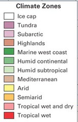
Climate

answer
- weather conditions in a region over a long time
question
Elevation
answer
- the height above sea level
question
Relief
answer
- the variation in elevation across an area of Earth's land
question
Relative location
answer
- location in relation to other places
question
Absolute location
answer
- the exact position of a place on the Earth's surface
question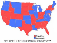
Thematic Map

answer
- a map that emphasizes a particular theme or special topic such as the average distribution of rainfall in an area.
question
Latitude
answer
- An imaginary line around the Earth from east to west.
question
Longitude
answer
-imaginary lines that bisect the globe through the North and South Poles.
question
Equator
answer
- The line of latitude that is at 0 ̊. From this point we measure the distance north and south.
question
Prime Meridian
answer
- The line of longitude that is at 0 ̊. From this point we measure the distance east and west.
question
Economic
answer
- The way a society acquires, process, and distributes resources
question
Cultural

answer
- The common behaviors, possessions, and beliefs of a people.
question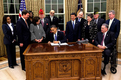
Political

answer
- The government system - the act of governing the people.
question
Great Circle Route
answer
- the shortest distance between two points on a sphere.
question
Demography
answer
- the study of human populations, including how they change due to births, deaths, aging, and migration.
question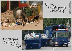
Development

answer
- steady improvements in a country's economy and in people's quality of life.
question
Less Developed (Periphery)
answer
- countries that are less productive economically and have lower standards of living.
question
More Developed (Core)
answer
- a wealthy country with an advanced economy; many industries and a comfortable way of life for most of their people.
question
Developing/Newly Industrialized (Semi-Periphery)
answer
- countries that have features of both more developed and less developed countries; Cities may be modern but rural areas and small towns are poor.
question
Formal regions
answer
- designated areas that have official boundaries such as counties, cities, states and countries. Ex. USA, Texas, Collin County, Allen.
question
Functional regions
answer
- Different places that are linked to together and function as a unit. Ex. DFW airport
question
Perceptual/Vernacular regions
answer
- Places that reflect human feelings or attitudes. Ex. The South, Dixie, "back home"
question
Spatial perspective
answer
-The way things are spaced out or positioned on the Earth is at the heart of geography and the way it seeks to understand the world.
question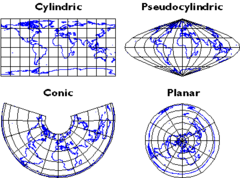
Map projection

answer
- a mathematical formula used to represent the curved surface of the Earth on the flat surface of a map.
question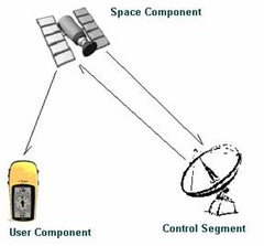
Global Positioning Systems (GPS)

answer
- a navigational system involving satellites and computers that can determine the latitude and longitude of a receiver on Earth by computing the time difference for signals from different satellites to reach the receiver
question
Geographic Information Systems (GIS)
answer
- a computer system capable of assembling, storing, manipulating, and displaying geographically-referenced information,
question
Region
answer
- an area with one or more common features that make it different from surrounding areas.
question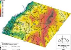
Topography

answer
- The shape and position of Earth's physical features.


